Day four was sort of planned but not really. We had activities we hoped to do but were not sure if we would be able to. The main activity was visiting Antelope Canyon. There are two main areas of Antelope Canyon which is on Navajo land and you can only enter with a Navajo guide. There is the Upper Antelope Canyon which is the most popular and where you are mostly likely to see light beams in the canyon if it is the right season (summer) and the right timing (usually around noon-ish). These tours tend to sell out first (even with five tour operators) and are also the most expensive (probably because they are the most popular).
Then there is Lower Antelope Canyon which is also beautiful but the chance for light beams is much smaller and requires a more strenuous hike that involves ladders. Also, because the upper canyon are is in an A-frame (wider at the bottom and more narrow at the top) it is easier to walk through. The lower canyon is more of a V-frame meaning it’s narrow at the bottom (where you are walking) and wider on top. Not too mention the lower canyon tours are cheaper and usually less crowded since there are only two tour operators.
There are also a few other slot canyon tours including Canyon X which we considered going to if we could not get spots on the other tours or also had extra time. This is a newer and less well-known tour but could be a good option if the others are all full or you just want a less crowded experience since only one tour group operates here and it has both A and V frame slot canyons. There is a descent through stairs to reach the canyon but nothing like the lower canyon tours. This tour is also cheaper and is operated by Taadidiin Tours.
Upper Antelope Canyon (Antelope Canyon Navajo Tours)
Highway 98, Milepost 299, 8, Page, AZ 86040
When my parents came to page a few years ago, they ended up taking a lower canyon tour by coincidence since it just happened to be the first tour company they stopped by and just walked in to a tour. I did tell my mom that with her walking condition, the upper canyon tour was the easiest to walk but also the busiest. She still insisted there was no need for a reservation since they were able to walk in before even though that was for the less popular lower canyon.
When we arrived in Page, I checked online and most upper canyon tours were all fully booked with a random one person slow available here and there. My mother (the ever optimist) still insisted that we could try walking in. Worst case, she would stay behind and my dad and I could go on a lower canyon tour or maybe we would try the Canyon X tour. In the end, we decided to stop by the upper canyon tour operator Antelope Canyon Navajo Tours since they were closest to the lower canyon operators.
By absolute luck, they were able to fit us on the next tour that would start in about 45 minutes. However, walk-in reservations did have to be paid fully in cash and it was $100 per person for about a 90 minute tour. Something to keep in mind if you are trying to walk-in. Other things to know are that they have porter-pottys at the check-in are but not by the canyon so if you need to, use them while waiting. Each group is also only allowed one bag and you are not allowed to bring any tripods or selfie sticks. If absolutely needed, they will allow you to bring walking sticks or trekking poles. Also, as of early March 2022, the Navajo Nation still had a mask mandate and you need to wear a mask whenever on Navajo grounds, including in the canyon. They would not let you take off your mask for photos. In fact they stated if anyone did so, they would immediately be removed and brought back to the parking lot.
Unlike the lower canyon where you can just walk over to the canyon, for upper canyon tours you have to be driven over and each tour operator drives a different vehicle. Ours used trucks with a semi-open seating area that could fit up to 12 people. The ride can be a little bumpy in certain parts. Some of the other tour operators had enclosed vans if that is your preference. Though there are five different operators, they are all owned within one Navajo family.

Our tour guide was Sherry and she was amazing. She drove us over to the slot canyon and then went over some of the history. We were the last car from our tour operator for our time slot although there were already a lot of other tour operator vehicles parked there so there must have been quite a few groups already inside. We took a little longer because we had a few hearing-impaired people with us so Sherry would either write out some information for them or sign some information before speaking with the rest of us. This worked out though because as the last group for the time slot I feel like we had a buffer from the group in front when walking through and for photos.

When we went inside and began to walk through, we came to realize what a pro our tour guide Sherry was. She told us about the canyon and about different “images” you could see in the rock (kind of like when you see animals or items when looking at clouds). She also told us the best ways to take photos and helped with phone settings and filter. She was really good about not letting the group behind us push us forward to quickly and making sure we all got the photos we wanted before moving on. She also helped take a lot of group photos, individual photos and just photos on the slot canyon. We never felt any huge pressure to rush and ended up with a lot of great photos.


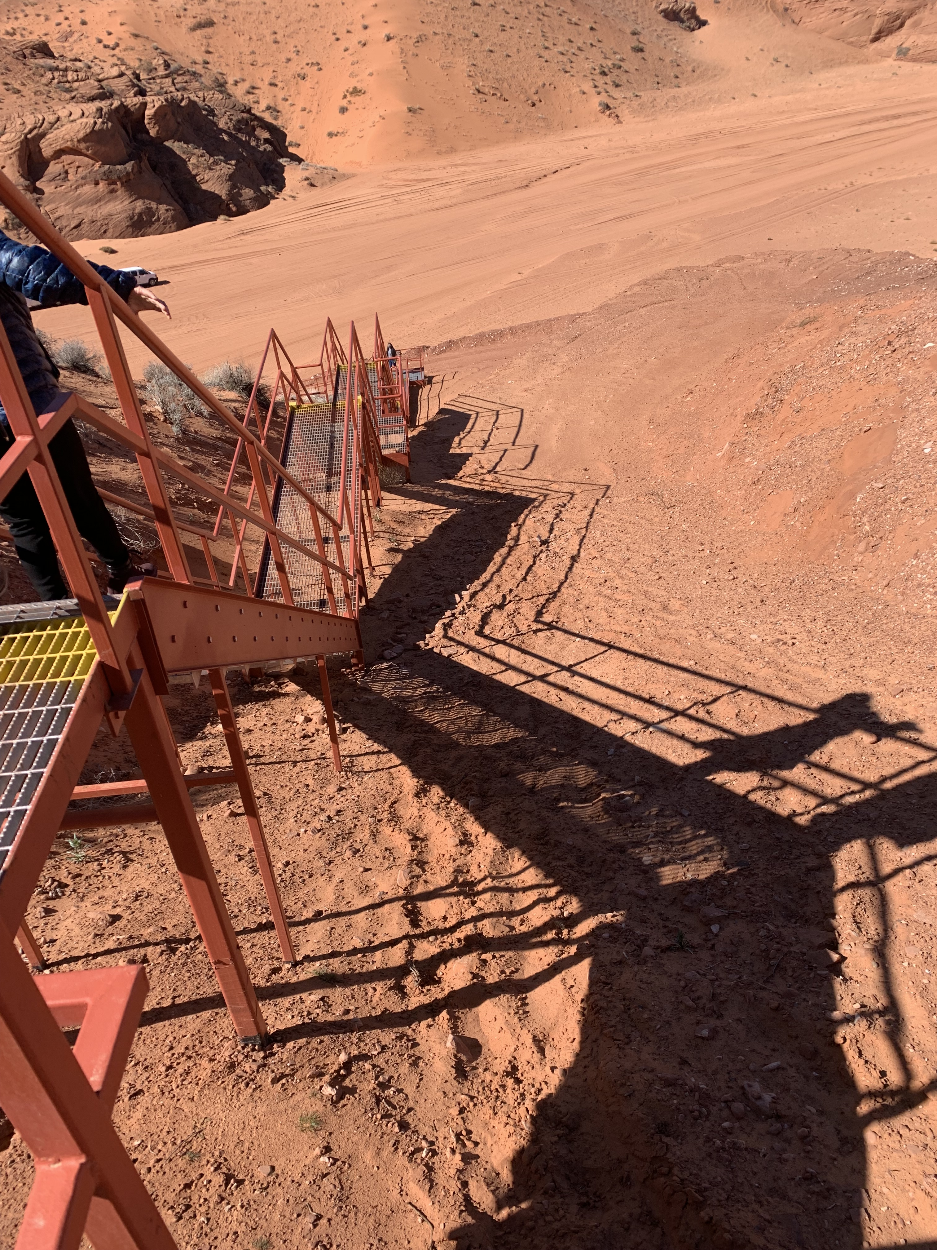
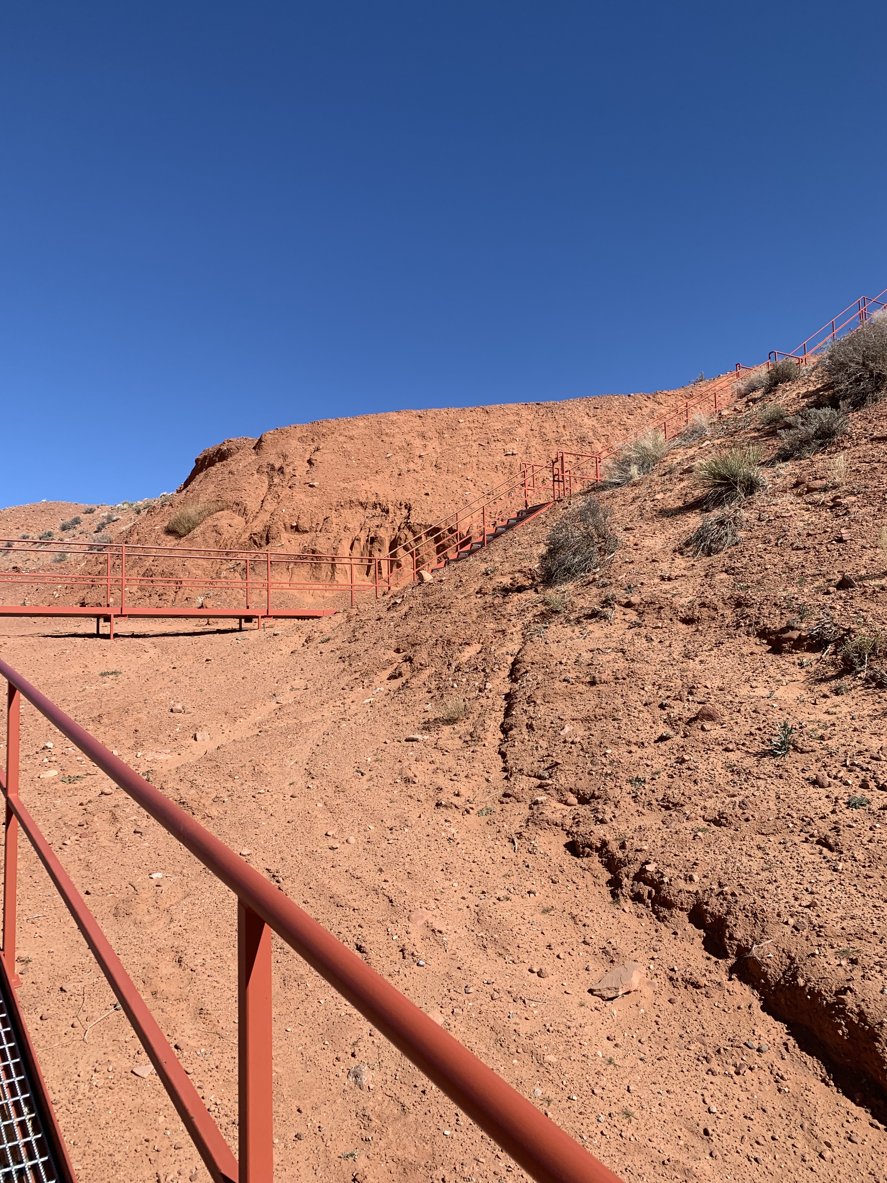
After you walk through the slot canyon (which is even elevation throughout), you exit and then have to go down a set of stairs. This was unexpected because I had not read anything about the stairs and change in elevation upon exiting and was a bit worried since it would be quite challenging for my mom. Luckily, Sherry did not rush us and we just took it slowly.
After descending, we got back on the truck and headed back to the parking lot. Sherry was an amazing tour guide so we tipped her in cash but she also had a QR code for her Venmo account for tips.
My mom did ask if I also wanted to go to Canyon X but since the upper canyon had the unexpected descent down the stairs and Canyon X also had some stairs in the beginning, I figured the beauty of the upper canyon was enough for one trip and instead we made our way towards Glen Canyon Recreational Are and Lake Powell.
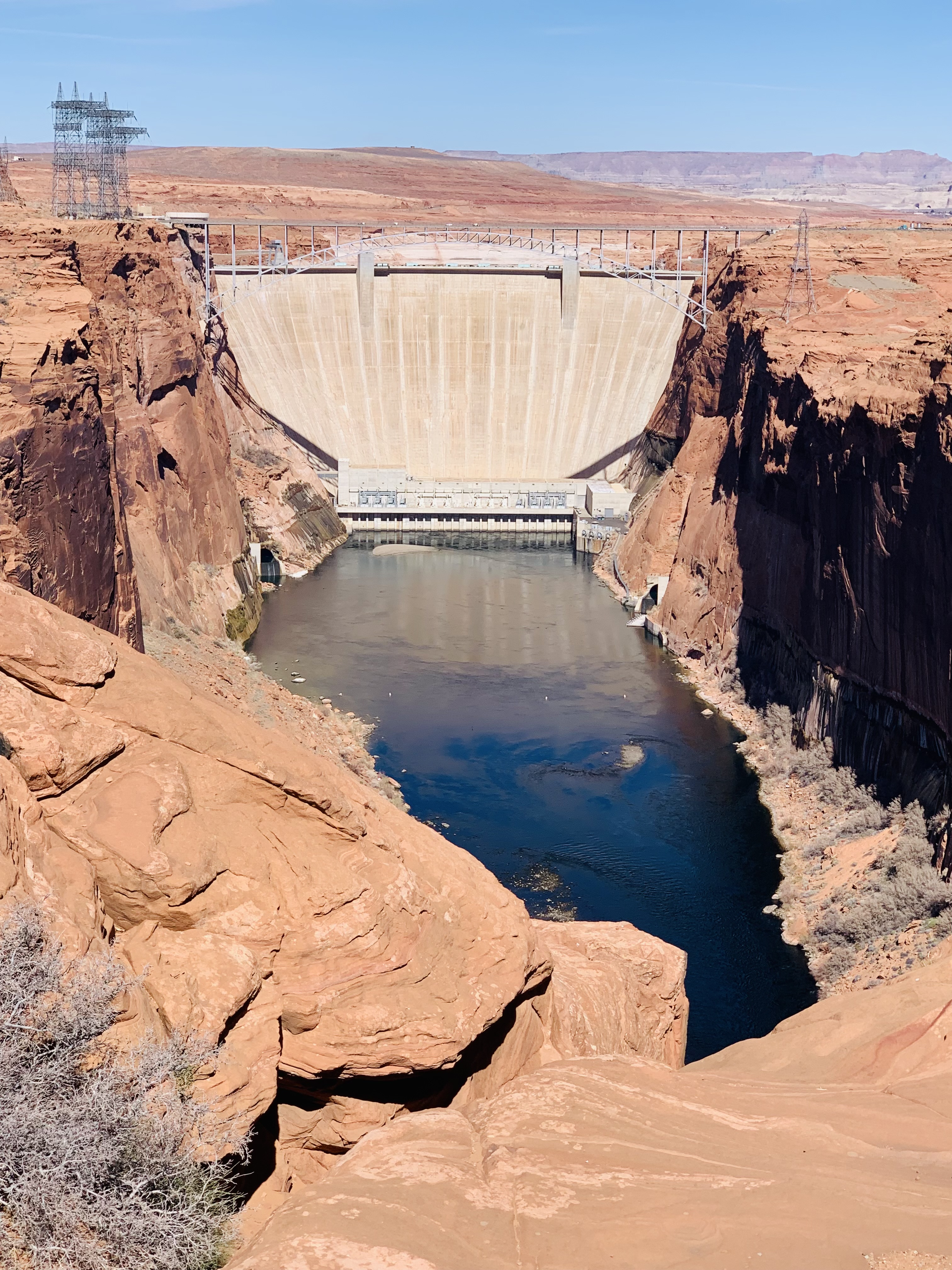
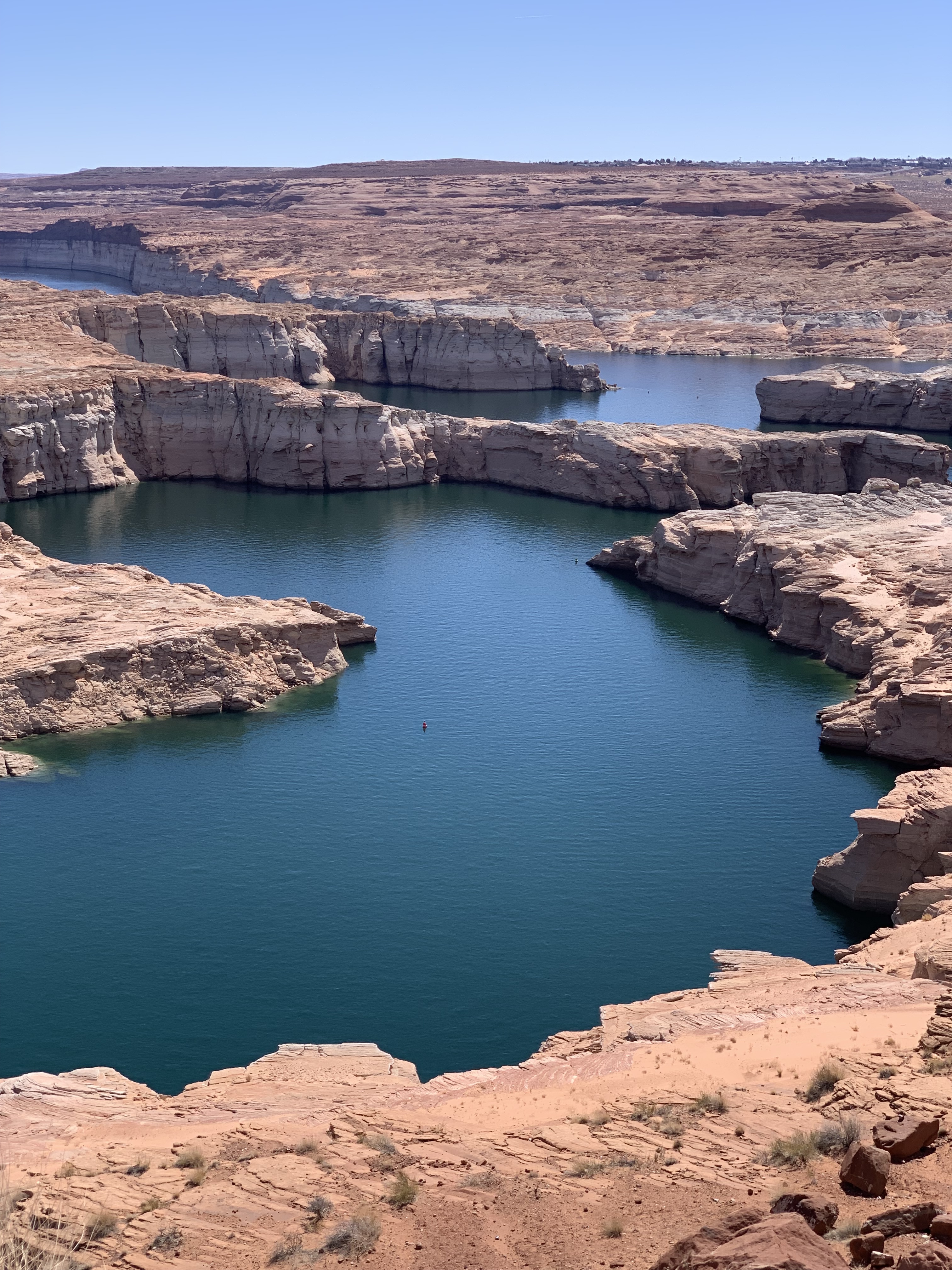
One thing to keep in mind is that while we were there, Lake Powell was at historic low water levels and the Colorado River was also at low levels. Originally, a bunch of people told us to take the boat cruise tour on Lake Powell but water levels were too low so there were no tours operating. We even kept hope and drove over to the Wahweap Marina but honestly, at the few stops we made beforehand, we already knew the answer.
Our first stop was at the Glen Canyon Dam Overlook that has views of the dam from afar. You can also drive to the Carl Hayden Visitor Center for a more up close look but we did not. My parents said they think they might have the last time they were in the area.
Instead we continued into the national recreational area where you do need a park pass. We stopped by Wahweap and also Lone Rock Beach. We were originally planning to eat at the resort in Wahweap but their restaurant was only open for dinner. I think the drought was most obvious when we were at Lone Rock Beach. When I was there I thought it was just another rock-like structure jutting out but apparently the rock is usually at least partially submerged in water but when we were there, there was no water to be found.

Eventually we headed back and instead had lunch near our hotel at New York Teriyaki which served Japanese and Korean food. It was okay. The sushi was a bit on the small side and my dad’s pork katsu was so overly fried there was almost no meat left. While we were eating I was looking up what else there was to do in the area. My mom mentioned going to Grand Staircase-Escalante National Monument which on the map did not seem that far but when I looked up places to see there, they were further north then expected and I also read something about some unpaved switchbacks or something so we decided against it.
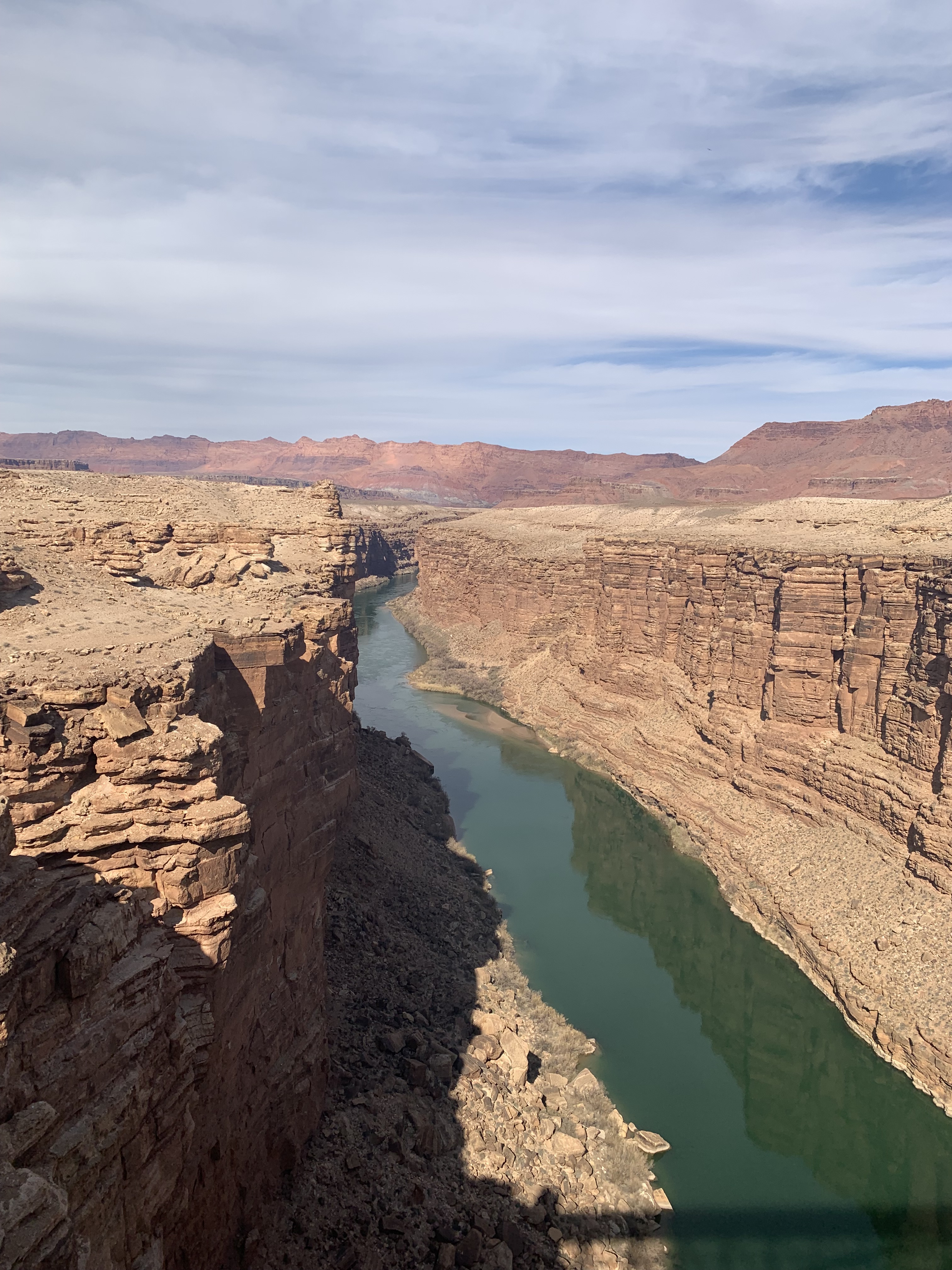
Instead, I stumbled upon some blogs about driving the US-89A Fredonia-Vermillion Cliffs Scenic Road that starts in Bitter Springs (just south of Page) all the way to Kenab, Utah. The first half of the drive basically borders Vermillion Cliffs National Monument which is some really amazing landscape. An great first stop is in the Marble Canyon area at the Navajo Bridge.
Navajo Bridge
1000 US-89A, Marble Canyon, AZ 86036
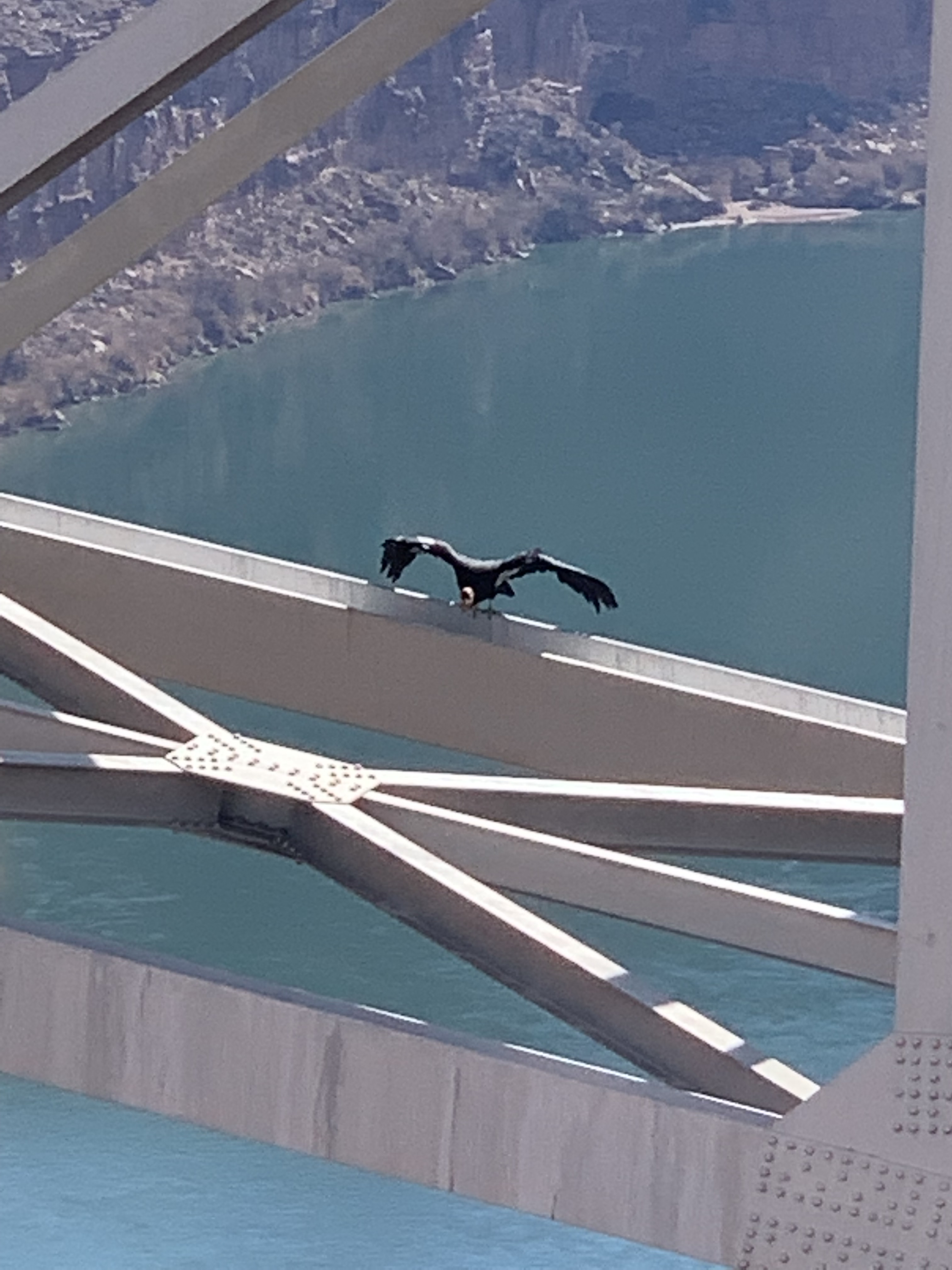
To visit the bridge, it is best to park at the Navajo Bridge Interpretive Center which includes a gift shop and restrooms. Then you can walk over the pedestrian bridge that crosses over the Colorado River and is parallel to the bridge for automobiles you just crossed. On the other side of the bridge there is some more parking and the set-up of what looks like a small market for local goods. As you are walking along the bridge, you can see the river below and then above in the sky and sometimes along the bridges or the rocky cliffs are the endangered California Condors. There were quite a few in the area when we were there and even a few amateur bird watchers set-up on the bridge to view their activity.

After leaving Navajo Bridge, we took a small detour from the US-89A and drove over to Lees Ferry which is a launching ground for a lot of rafting trips on the Colorado River through the Grand Canyon.
Lees Ferry
Spencer Trail, Marble Canyon, AZ 86036
On the drive down the launch ramp, there are a few areas you can pull over for views or trailheads. We pulled over at a few but did not walk any trails. Instead we drove down to the launching ground and saw a lot of people preparing for there trip. I also read online that the area is great for fishing including fly fishing. There are also campgrounds if you prefer camping.


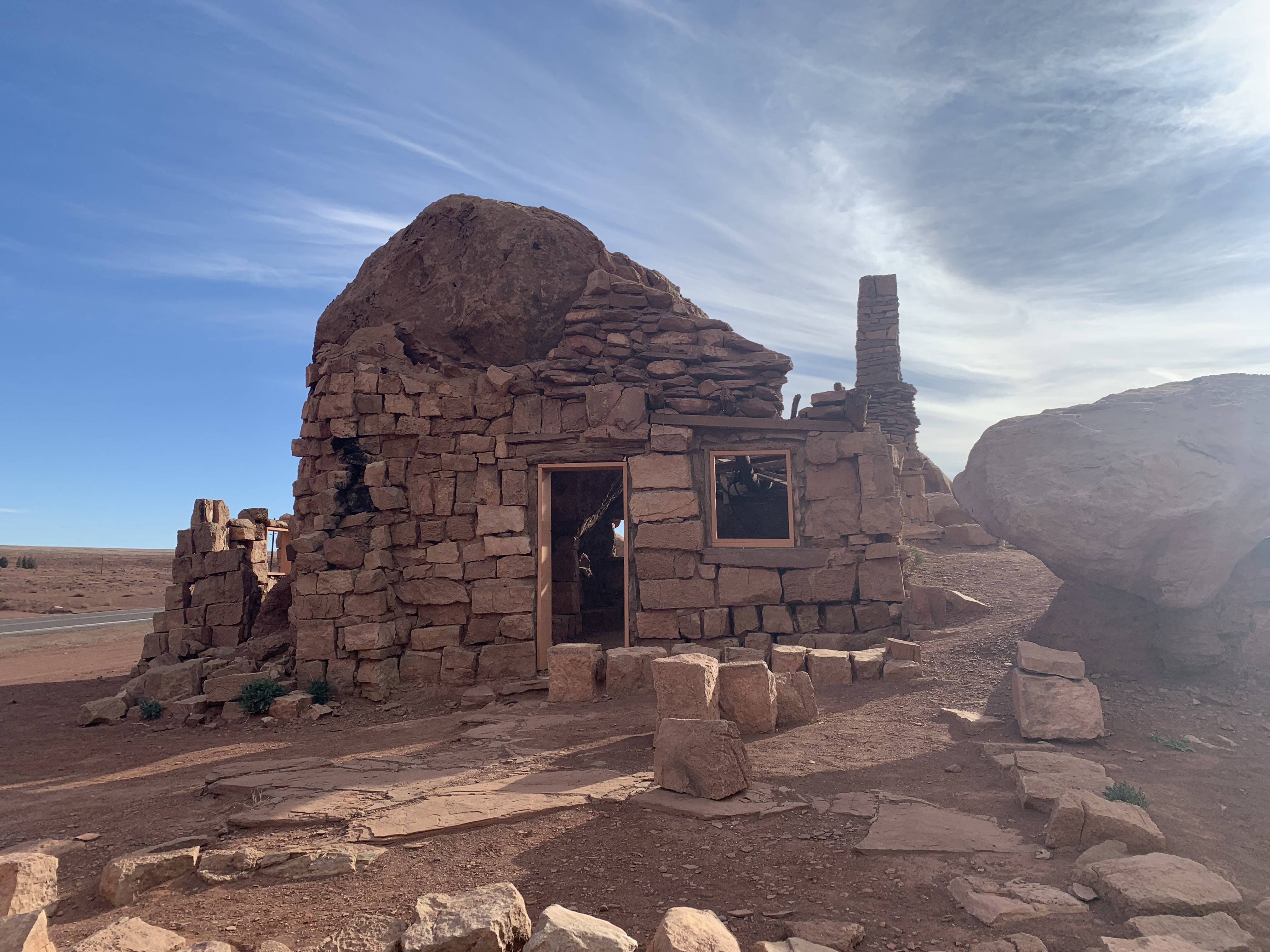
Eventually we headed back on the US-89A and continued onto the Cliff Dwellers Stone House where there really was a house made of stone.
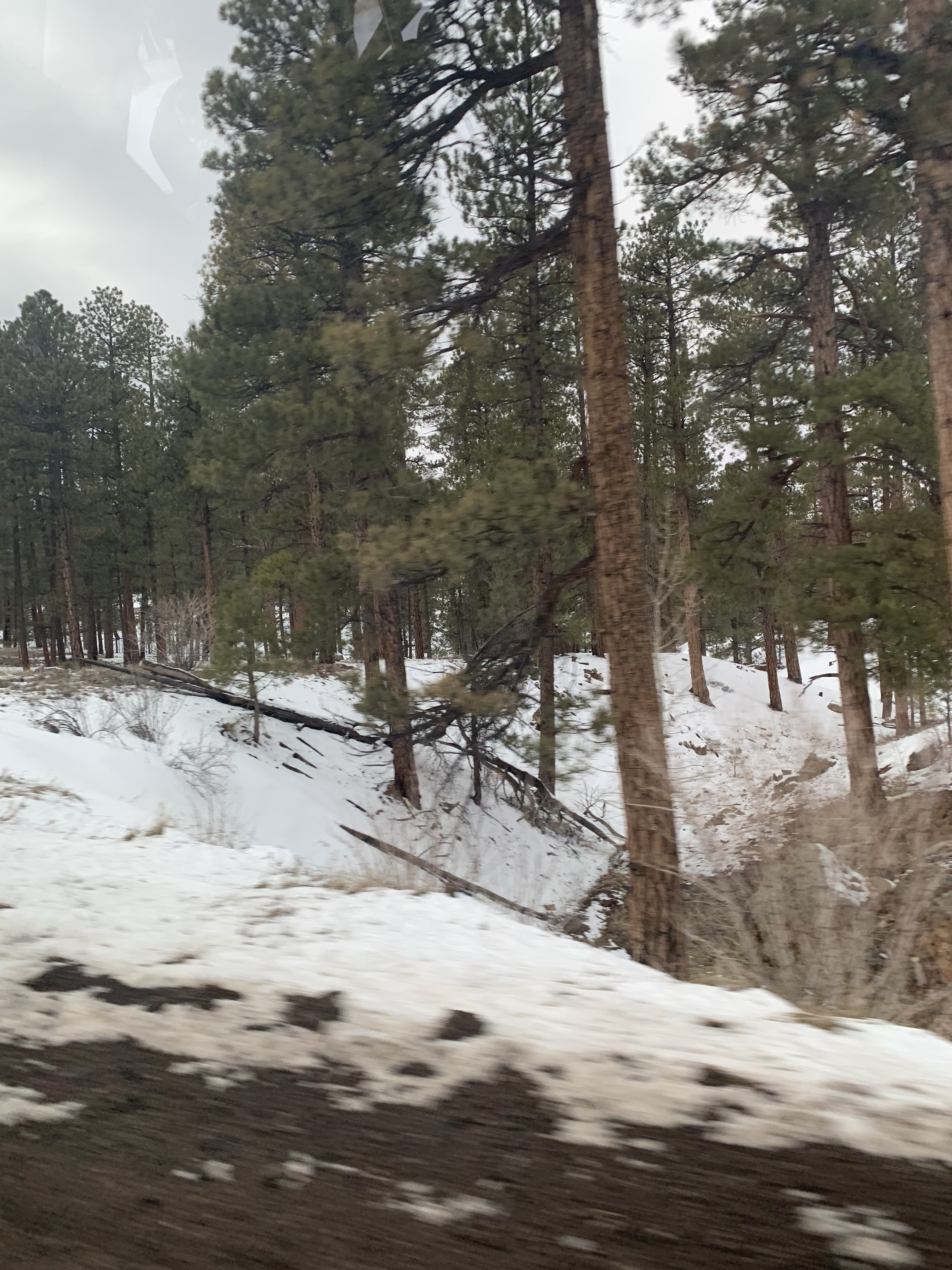
We then drove along the beautiful Vermillion cliffs with the red banded stone until we eventually entered Kaibab National Forest. Up to this point, the drive had been fairly easy with no elevation gains but on our way to our next stop, Le Fevre Overlook, there was quite a bit of elevation gain as we winded up the cliffs. This was unexpected because I did not see anything indicating it would turn into a more difficult drive and it was compounded by the fact that there was still snow (though it was not actually snowing) all along the forest and it was quite cloudy.
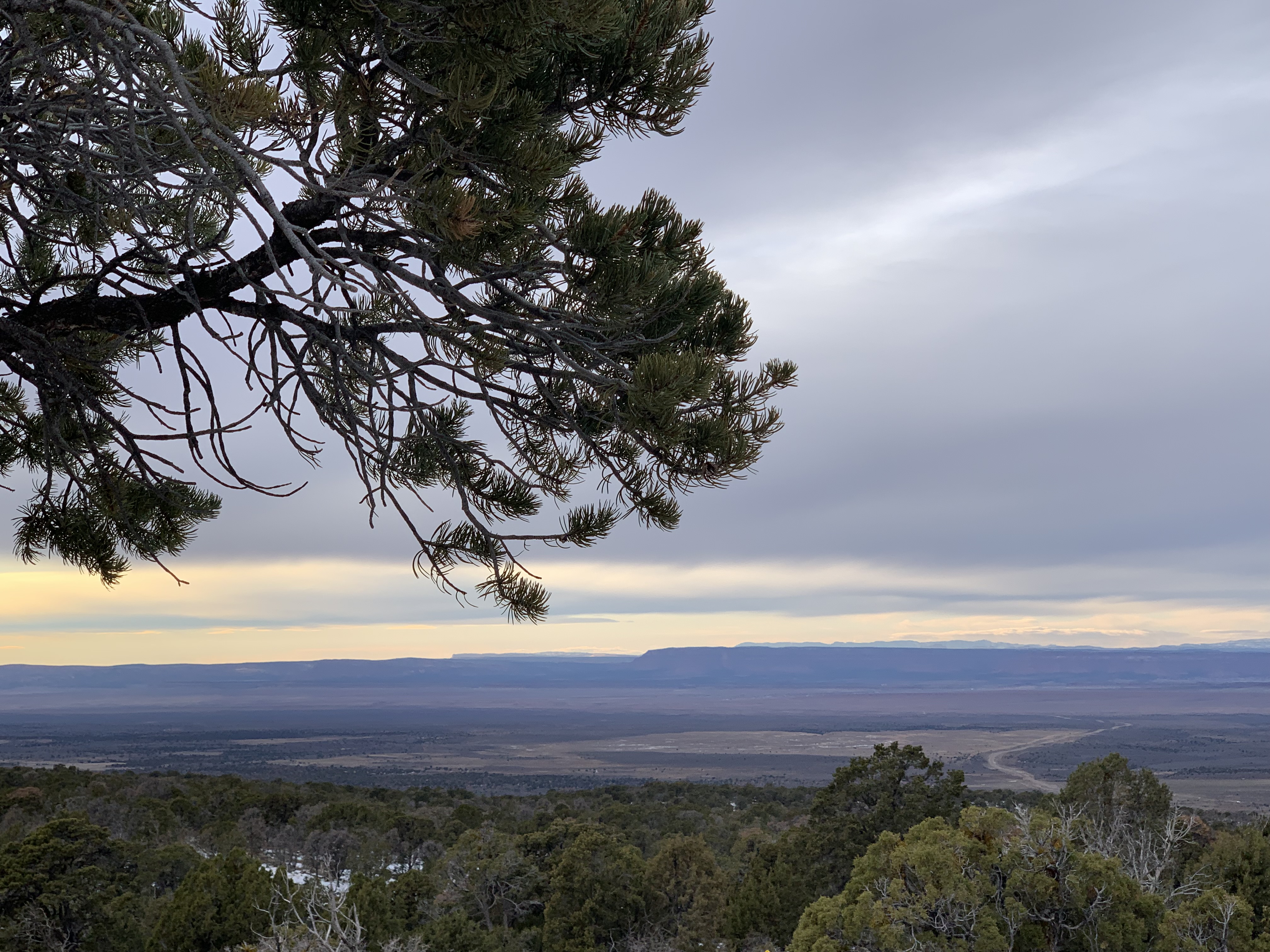
We eventually wound our way up to Le Fevre Overlook, where you are able to see views of many of the famous parks from afar set up like a staircase of different colored cliffs. There is even a standing binocular there for you to use. From it, you are able to see Grand Staircase-Escalante National Monument, the cliffs of Bryce Canyon National Park, Zion National Park and more. It was unfortunately, quite gloomy that day though or the view probably would have been even more impressive.
Thankfully, once you have passed the overlook, the road begins winding back down and you enter the town of Fredonia in Arizona and then cross into the town of Kenab in Utah. Kenab is also a great base for visiting some of the other national parks and monuments in the area. There are a few hotels in the town and it is not too far from Zion National Park, Bryce National Park or Grand Staircase-Escalante National Monument.
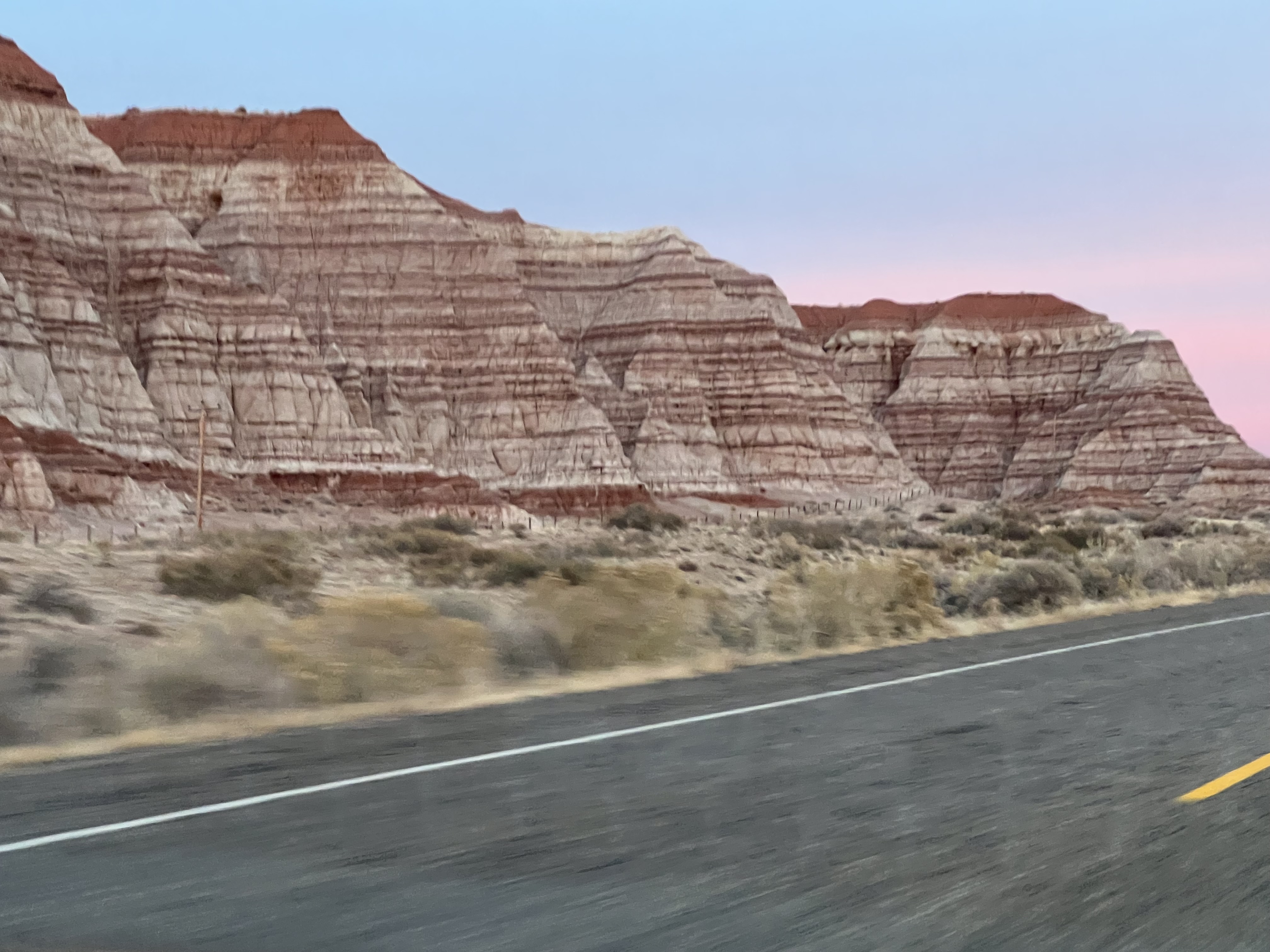
By the time we reached Kenab, we were getting close to sunset so we did not make any stops and instead continued on so we would not need to drive too long in the dark before reaching Page. This time, we took the US-89 instead of the US-89A. Honestly, they are both pretty scenic but the US-89 is much easier to drive since it does not have the escalation gain the US-89A has through Kaibab National Forest. Either drive is maybe a little over an hour (or more if you make stops). The US-89A has the views of the Vermillion Cliffs but the US-89 also borders the southern side of the Grand Staircase-Escalante National Monument and we saw lots of beautiful, distinctly color-banded cliffs on the drive back to Page.

When we got back to Page, it was already nightfall and we drove into the town center to get takeout from The Birdhouse. We got some fried chicken sandwiches and salad and they were pretty good. The sandwiches were made using to fried chicken tenders and you could choose to have your chicken original, very spicy or honey butter.
It was funny because my parents stayed on the outskirts of town during their last trip too so they thought Page was super small with barely any retail or residential areas and were surprised when we drove into town to get the food. We were able to park easily but I have a feeling during hot season, it would be much much harder as the restaurants around town already seemed kind of busy.
This post is part of a series:
